(1) A global tectono-stratigraphic computer-GIS database of the Palaeoproterozoic Era, with cross links to existing geochronological, stable-isotopic, and palaeomagnetic databases for the same period of time.
The database is located at the following website…
http://thera.usask.ca:8091/?progname=IGCP509
Regional coordinators: please follow this link to begin uploading data into our database system. This will be the primary means of populating our database, from which we (especially Bruce Eglington) are working on an automated means of producing draft versions of the correlation charts as described below.
http://sil.usask.ca/SDB_compilations.htm
(2) A global tectono-stratigraphic correlation chart illustrating major events in Palaeoproterozoic Earth history, as related to the preserved geological record. This chart will be modeled (with a modified legend) after examples found in
Wardle et al 2002. CJES 39, p 895. (Subscribers to CJES can download the pdf of the chart here, or from the NRC webpage.)
and
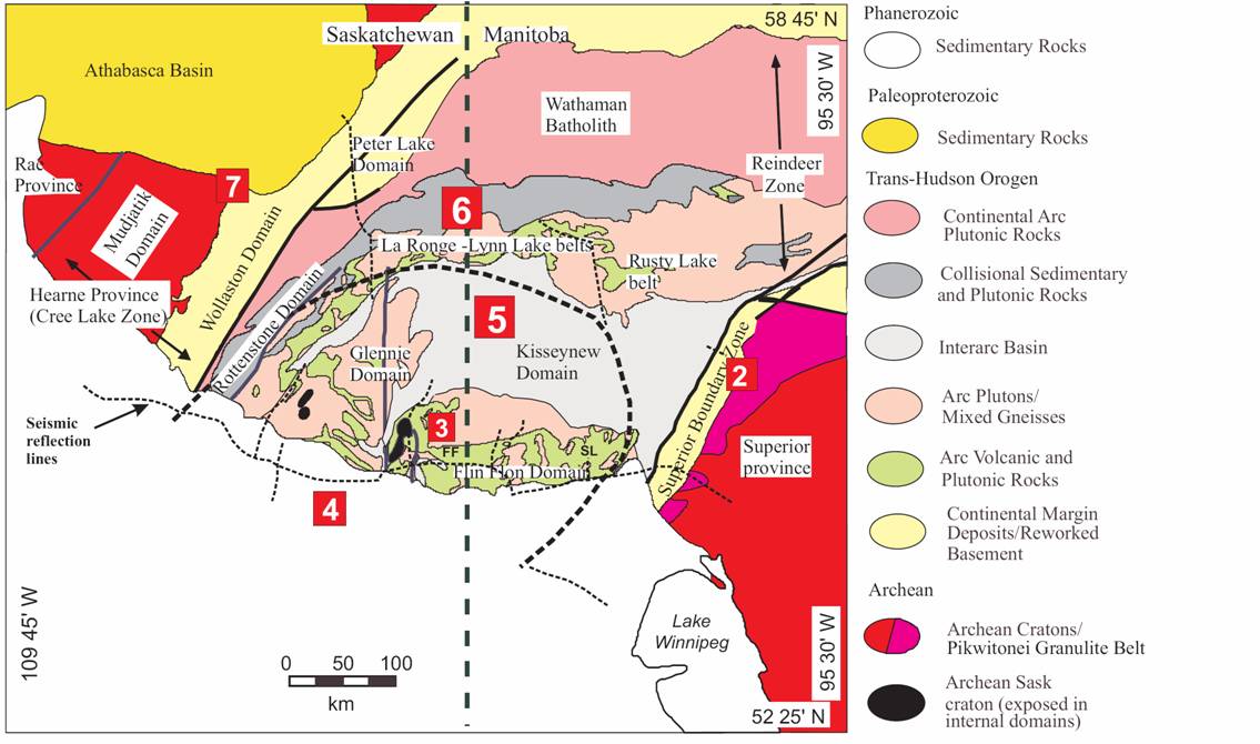
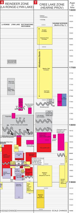
Ansdell et al. 2005. Correlation Chart of the evolution of the Trans-Hudson Orogen - Manitoba-Saskatchewan segment. CJES 42, p 761. (Subscribers to CJES can download the pdf of the chart here or from the NRC webpage.) below are some sample excerpts from this chart….
(3) A set of global palaeogeographic maps through the Palaeoproterozoic interval, including a “best guess” for the configuration of Nuna supercontinent. As of the project’s closing in 2009, there may be several viable Nuna reconstructions, all depicted in a series of maps. The maps will include major sedimentary basins, orogenic belts, large igneous provinces, impact craters, and economic deposits.